
Common Mountain [Sliabh Chamain]
Good walks are even better shared.
Overview
Common Mountain [Sliabh Chamain]
Sliabh Chamain, affectionately known just as Common Mountain, stands at an elevation of 703 meters in the stunning Mourne Mountains of Northern Ireland. This Marilyn ranks among the gem-like peaks of this heavenly range and is well-loved by local hikers and outdoor enthusiasts alike.
Geology
The mountain showcases impressive granite formations, typical of the broader Mourne region. This resilient stone provides a lasting foundation for the various landscapes and diverse wildlife that call this area home. As you traverse, keep an eye out for interesting weathered rocks that have tantalizing tales of the earth's history etched in every crevice.
Routes
Hiking enthusiasts will find a couple of popular routes leading to the summit:
- Shane's Castle Route: A moderate trek starting from Shane's Castle that covers 7.5 km. The trail is well-marked and offers splendid views throughout.
- Carlingford Route: A more challenging 6.2 km route beginning in the Carlingford area. While the incline might take your breath away (quite literally), the views are well worth the effort!
Summit Features
At the peak, the impressive trig point stands as a beacon for adventurers. It’s the perfect stop for a snapshot and a chance to catch your breath while feasting your eyes on the breathtaking panorama.
Terrain
Expect a mix of grassy patches interspersed with rocky outcrops and the occasional boggy bit that might try and claim your shoes. Proper footwear is recommended to navigate this varied terrain.
Views
From the summit, you can bask in views of the iconic Mourne Wall and its neighbouring giants, including Slieve Donard. Don't forget to check for the glimmering coast of the Irish Sea; it feels even more rewarding with a light sea breeze!
The best times to visit are during Spring and early summer when the weather tends to be clear and the flora is in bloom, providing an extra layer of beauty to your journey.
Hazards
Be cautious on the rocky parts, particularly after rain, as they can turn slippery. Also, be prepared for quick weather changes and bring along a waterproof jacket just in case the heavens decide to open!
Access
Nearest Parking
Parking is conveniently located at Shane's Castle, where you can easily find the trail leading to Sliabh Chamain.
Public Transport
Public transport is accessible from Belfast to Antrim, with regular buses servicing the area. A quick taxi ride will land you at the base of the mountain.
Nearest Town
Castlewellan is the closest town, a charming spot to gather your supplies or grab refreshments.
Facilities
While the mountain doesn't offer facilities, Castlewellan is nearby and hosts cafes and other amenities that cater to thirsty and hungry hikers.
History
Name Meaning
The name Sliabh Chamain stands for 'the mountain of the wild boar,' paying homage to wildlife that once roamed the hills.
Significance
This mountain holds a place in local lore, steeped in stories of ancient clans and mystical tales that serenaded the peaks.
Combine all this with the stunning scenery and you've got a cracking day out. So lace up your boots, grab your trusty walking stick, and make your way to Sliabh Chamain for an unforgettable adventure!
Explore routes near Common Mountain [Sliabh Chamain]
Public walks starting within 80 km of this hill. Nearby does not mean a route reaches the summit; check its map and access before setting out.
Florence Court: Riverside and Forest Circuit, County Fermanagh
View route
Derry~Londonderry City Walls Circuit
View route
Route planning notes
These notes describe possible approaches, not verified navigable routes or permission to cross land. Check current paths, local access rules and conditions before setting out.
Shane's Castle Route
A straightforward path leading up from Shane's Castle, offering excellent views of the surrounding countryside.
Carlingford Route
Starting from the Carlingford area, this route winds through lush greenery before tackling the ascent directly to the summit.
Make a day of it, together
Find someone to share the walk with, or organise a day out along a route you like.
Hill facts and local notes
Classifications
Elevation
500m
1,639 ft
Prominence
319m
Coordinates
54.7206, -8.4521
G709859
OS Map
10
At the Summit
The summit is marked by a prominent trig point, offering panoramic views of the surrounding peaks and valleys, ideal for that perfect Instagram snap. During clear weather, you might even spot the coast of the Republic of Ireland afar.
Terrain & Geology
Sliabh Chamain features predominantly granite formations, typical of the Mourne Mountains, providing a robust base for the stunning landscapes and diverse habitats found in the area. The granite has weathered over millennia, resulting in interesting boulders and rocky outcrops that dot the landscape.
Views & Scenery
From the summit, one can enjoy views of the Mourne Wall, the Slieve Donard mountain range, and even the shimmering Irish Sea on a sunny day.
History & Heritage
Name Origin
Sliabh Chamain translates to 'the mountain of the wild boar' in Irish, a nod to the wildlife that once roamed these hills.
Historical Significance
This mountain and its surroundings have been significant in local folklore, often seen as a mystical place filled with tales of ancient clans and nature spirits.
Getting There & Facilities
Check current local access restrictions, parking rules and transport timetables before travelling. These notes do not confirm public access to the summit.
Parking
Parking is available at Shane's Castle, with appropriate signage directing hikers to the starting path towards Sliabh Chamain.
Public Transport
Buses from Belfast to Antrim run regularly, with services stopping near the Mourne Mountains. From there, it's a short taxi ride or a piquant walk to the trails.
Nearby Facilities
There are no facilities directly on the mountain, but nearby Castlewellan boasts several cafes, pubs, and public restrooms. Perfect for a post-hike celebration (or recovery).
Safety Information
Known Hazards
- Care should be taken on the rocky sections, particularly in wet weather. Some paths can become slippery and treacherous.
- Beware of sudden weather changes; pack a waterproof jacket just in case!
General Safety Tips
- Check weather conditions before setting out
- Carry appropriate clothing and equipment
- Let someone know your planned route
- Take a map, compass, and GPS device
- Carry emergency supplies: food, water, first aid kit, torch
Hills
Some common questions about the hills answered
Are there group walks up Common Mountain [Sliabh Chamain]?
Many walkers use Walkmates to join or organise walks with others. You can check for group walks around Common Mountain [Sliabh Chamain] through the maps
Are there other walkers around Common Mountain [Sliabh Chamain]?
Activity varies by location and time, but Walkmates lets you see whether others have shared walks or shown interest in this area. Find other people through the walking friends search walking friends for Common Mountain [Sliabh Chamain] search or of course create your own walk for Common Mountain [Sliabh Chamain]
Can I organise a walk to Common Mountain [Sliabh Chamain]?
Yes. If there aren’t any walks listed already, you can create a walk and make it available for others to join.
If you're signed up to Walkmates, you can create a walk to Common Mountain [Sliabh Chamain].
How do I find a walk up this hill?
There are often multiple ways to walk this hill, depending on experience and route preference. Walkmates helps you explore walks and routes that others have shared.
Can I suggest a new route up Common Mountain [Sliabh Chamain]?
Yes. You can suggest or create routes to share with others. Walkmates focuses on the social side of walking, so routes are used to help people organise walks and explore areas together, rather than as detailed navigation tools or route libraries.
Other uses really appreciate knowledgeable walkers sharing their routes. Share your favourite route to Common Mountain [Sliabh Chamain] here
The is an error or something incorrect about this hill. How do I let you know?
We always strive to keep the information on Walkmates as accurate as possible. If you find an error, please let us know through the contact form and we'll aim to correct it as quickly as possible
Community Discussion
Comments
Location
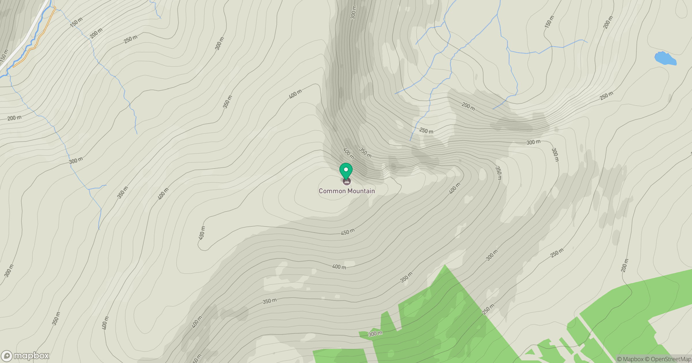
Grid reference: G709859
View on OpenStreetMapOpens a map in a new tab, centred on the hill.
Hills within 30 km
Straight-line distance, not a walking route or confirmation of access.
No comments yet. Be the first.